2022-2024 • Independent Projects

GIS Maps

Spatial Analyses using ArcGIS Pro

Navigating Urban Waters

Mapping Discrepancies between US Census Blocks Most Vulnerable to Pluvial and the Distribution of Green Stormwater Infrastructure in West Philadelphia

Navigating Urban Waters

Mapping Discrepancies between US Census Blocks Most Vulnerable to Pluvial and the Distribution of Green Stormwater Infrastructure in West Philadelphia

ArcGIS Pro Maps

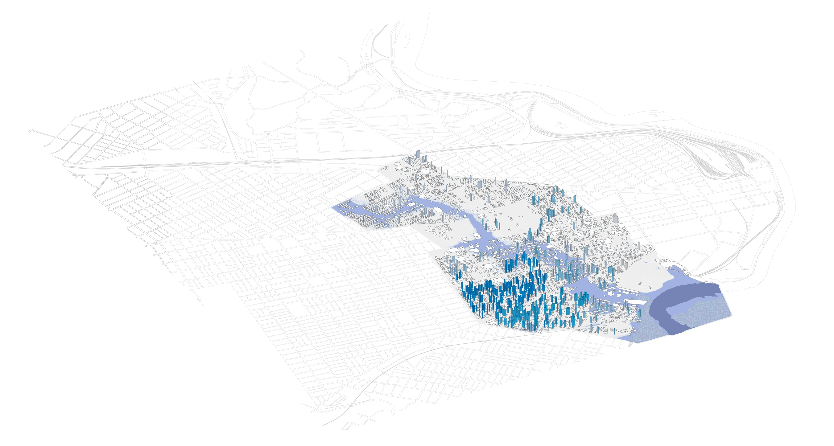
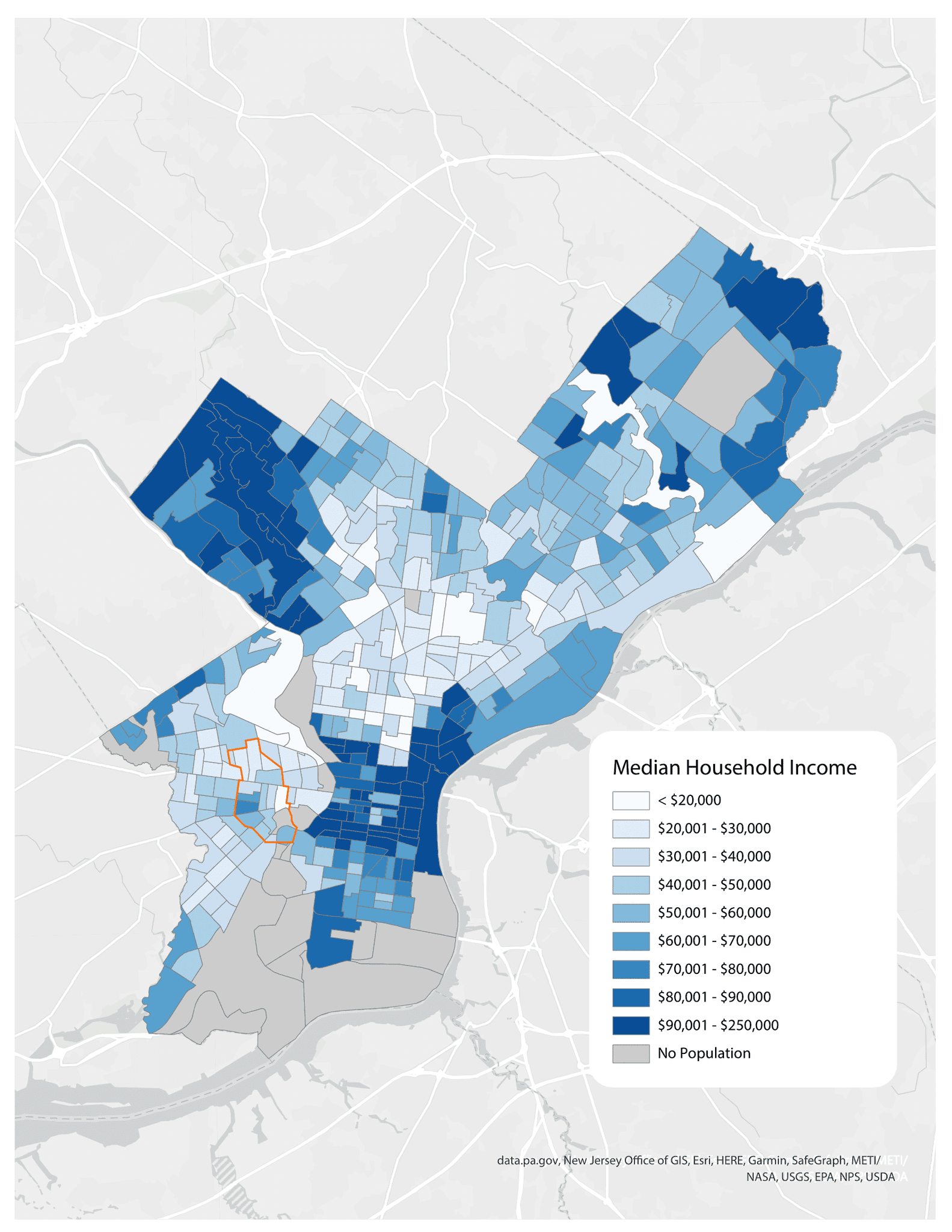
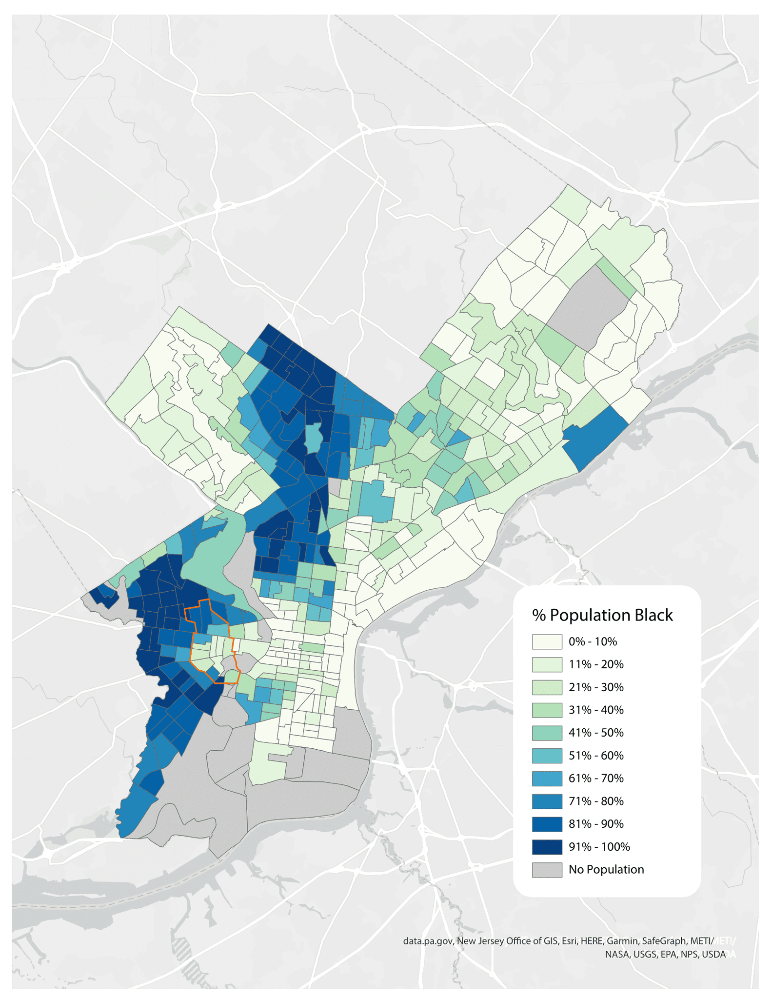
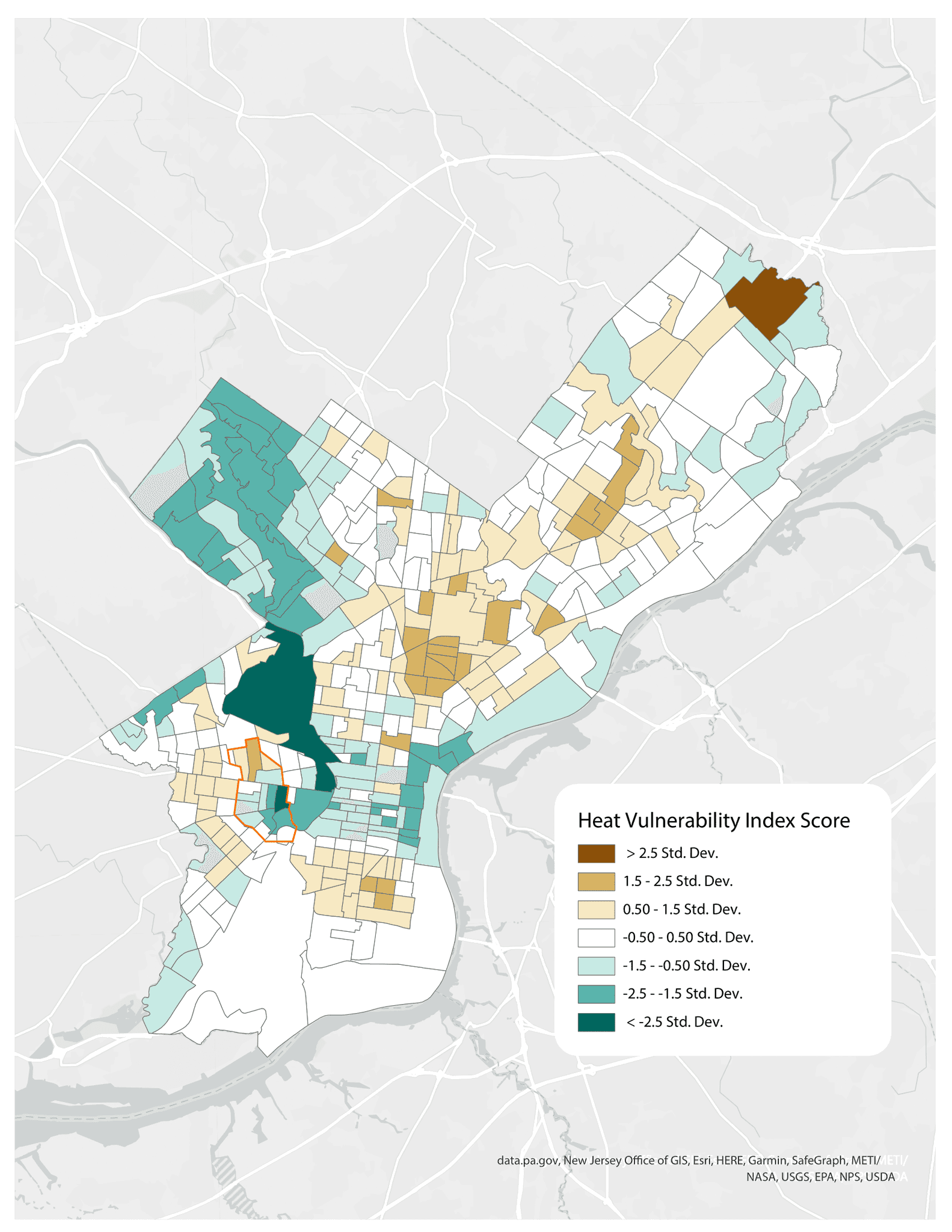
Median Household Income, Percent of Black Population, and Heat Vulnerability Index Scores by Census Block in Philadelphia, Pennsylvania (2020)

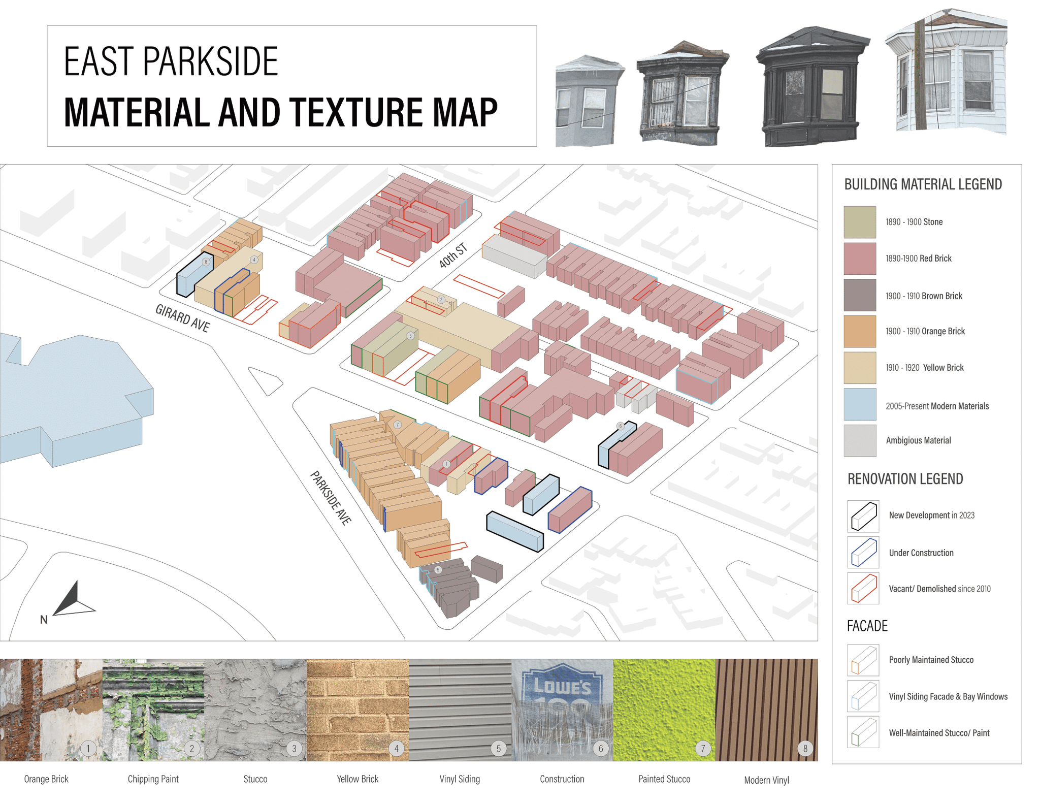
Material and Texture Map

East Parkside, Philadelphia

If you made it this far, why not check out another project? ☺︎

LORRAINE RUPPERT ✴︎

LORRAINERUPPERT ✴︎

LORRAINE RUPPERT ✴︎